Beaches and Parks

Explore Del Mar! Interactive Map
With a few quick mouse clicks, residents and visitors can gather information on Del Mar’s parks. “Explore Del Mar!” is an interactive map that shows the locations of 10 parks as well as a number of public paths and trails. By clicking on the map, users open windows showing locations, hours, rules, parking, transit, pet restrictions and other information. Each park description is illustrated with a photo
Explore the Interactive map by clicking here.

North Beach (Dog Beach)
North Beach, affectionately called “Dog Beach” by dog owners, is located north of 29th Street and stretches nearly one half mile to our border with Solana Beach. The area includes the mouth of the San Dieguito River and a stretch of coastal bluff. While laws restrict access to half of the Del Mar beach during the summer months, North Beach remains open to dogs; however, dogs must be restricted to a six foot leash. Learn more about dog friendly beaches here. View the Dog Beach live cam here.

Torrey Pines State Beach
Torrey Pines State Beach runs for three miles between Carmel Valley Road and the Glider Port at Torrey Pines Scenic Drive. The beach here is well covered by sand, with few exposed rocks, readily passable at all but the highest tides. There is also access from above via two challenging hiking trails – one in the State Park and another beginning at the Glider Port.

Powerhouse & Seagrove Parks
Two coastal parks, Powerhouse and Seagrove Parks, are located just above the 15th Street surf break, providing a great spot to picnic with friends and family. The Powerhouse Park also features a barefoot friendly, dog free “tot lot,” where kids can play on swings, slides, and climb. Seagrove Park and the adjacent Powerhouse Park comprise Del Mar’s crown jewel, and after you take in the view there, you’ll see why. The sprawling grassy knolls overlook the beach, making it a popular place to sunbathe or dine al fresco at one of the many picnic tables. To see the full scope of this area, begin at the outer rim of Seagrove Park and work your way down to Powerhouse Park, stopping along the routes to gaze at the sea and surfers below. If you walk past the “Tot Lot” play area at Powerhouse Park, you’ll find a small gateway that leads to a dirt path. Follow that trail to a cluster of benches where you can sit and bask in the sun. Seagrove Park is located off Coast Blvd.
For information about special event rentals of Powerhouse Park, Powerhouse Facility or Seagrove park, click here.
Powerhouse Park is located at 1658 Coast Blvd. Del Mar, 92014; 858-793-6138

Scripps Bluff Preserve
Perched above Del Mar’s Dog Beach is Scripps Bluff Preserve. Though it’s a relatively steep climb, the view is worth every step. Savor the sunset at this lesser-known preserve. The high vantage point on this bluff gives you a 360-degree of the coastline and the inland lagoons. So, not only can you watch the sun dip down over the Pacific, but you can turn and watch the sky inland change colors, which can be especially spectacular if there happens to be hot air balloons in flight. To access the bluff, use paid parking at North Beach (aka Dog Beach) along Camino del Mar. Dog beach is located at 3006 Sandy Lane, Del Mar, CA 92014. As you walk onto North Beach, look for a wooden staircase to your right. Follow the staircase up to a trail that leads you to the top of the bluff.
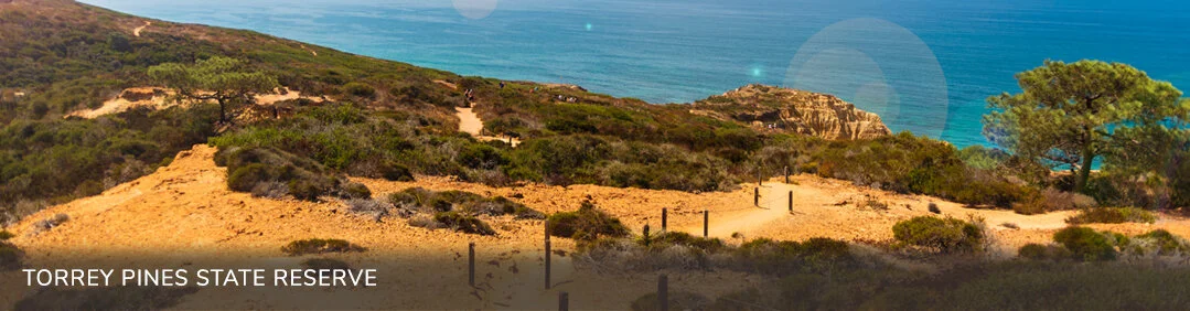
Torrey Pines State Reserve
Torrey Pines State Natural Reserve is located within San Diego city limits and yet remains one of the wildest stretches of land on our Southern California coast! Because of the efforts and foresight of the people in this area, 2,000 acres of land are as they were before San Diego was developed — including the maritime chaparral, the rare Torrey pine, miles of unspoiled beaches, and a lagoon that is vital to migrating seabirds. One can imagine what California must have looked like to the early settlers, or to the Spanish explorers, or even to the first California residents here, the Kumeyaay people. Torrey Pines is visited by travelers from all over the world and by local residents who come daily to rest at the stunning overlooks, walk a peaceful trail, or exercise in a clean, beautiful environment. Come spend some time at beautiful Torrey Pines State Natural Reserve.